Cambridge University Collection of Aerial Photography including photographs of Co. Kildare available online
The Cambridge University Collection of Aerial Photography (CUCAP) is the result of airborne survey campaigns which were started in 1947 by the pioneering John Kenneth Sinclair St. Joseph (13 November 1912 – 11 March 1994) an English archaeologist, geologist and Royal Air Force (RAF) veteran who pioneered the use of aerial photography as a method of archaeological research in Britain and Ireland. Since then the collection has grown to almost 500,000 images of obliques and verticals in black and white, colour and infra-red. Almost the whole of Britain and a large part of Ireland has been covered, with the obliques depicting a wide variety of landscapes and features and the verticals being of survey quality, can be used in mapping projects. The website address is https://www.cambridgeairphotos.com/ and you can click on the map to search across County Kildare and Ireland from there.
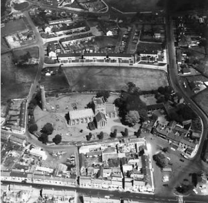
An example of the the of images available is this aerial view of Kildare town in 1969; CUCAP no.: AYP060
